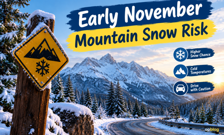
Early November Mountain Snow Risk As autumn moves toward winter, mountain weather across the United States can change quickly. A sunny afternoon may give way to falling temperatures, strong winds, and fresh snowfall within a few hours. For drivers, hikers, ski enthusiasts, and residents of high-elevation communities, understanding the early November mountain snow risk is an important part of preparing for the changing season.
Early November is a transition period when cold air begins reaching mountain ranges more frequently, while warmer conditions may still dominate nearby valleys. This contrast can create unpredictable weather, particularly when moisture from Pacific storms meets colder air over elevated terrain. Some areas may experience their first meaningful snowfall of the season, while others receive rain or only a light dusting.
Forecasts available in late October 2026 indicate that parts of the western United States could experience several periods of mountain snow during the opening week of November. Early November Mountain Snow Risk The National Weather Service’s Climate Prediction Center has highlighted a potential for heavy snow in portions of the central Rockies on November 1–2, followed by additional snow risks for the Cascades, Klamath Mountains, and northern Sierra Nevada during November 4–7. These are forecast risk areas, not guarantees that every mountain location will receive significant accumulation.
Understanding where snow is most likely, how quickly conditions can change, and what travelers should do before heading into the mountains can help people prepare for the season’s first challenging weather.
What Is Causing the Early November Mountain Snow Risk?
The main factor behind early-season mountain snow is the interaction between cold air, atmospheric moisture, and changing storm patterns. As weather systems move across the Pacific Ocean and approach the western United States, they can carry enough moisture to produce widespread precipitation. When these systems encounter sufficiently cold air at higher elevations, that precipitation can fall as snow.
Mountain geography makes the situation more complicated. Early November Mountain Snow Risk Air forced upward by steep terrain cools as it rises, sometimes increasing precipitation on windward slopes and exposed ridgelines. Two communities separated by a relatively short driving distance may therefore experience very different conditions, especially when one sits in a valley and the other lies several thousand feet higher.
Temperature is another important piece of the puzzle. A storm may bring rain to a lower mountain town while producing accumulating snow near the summit. If colder air arrives during the storm, the snow line can descend and affect roads that initially remained wet rather than snow-covered. This is one reason early-season forecasts require close attention to elevation-specific details.
Which Mountain Regions Could See Snow in Early November?

The western United States is a major focus of the current Early November Mountain Snow Risk outlook. According to the National Weather Service’s October 24 hazards outlook, several storm systems could bring periods of precipitation and high-elevation snow to parts of the West during November 1–7. The exact timing and intensity will vary between mountain ranges.
The Central Rocky Mountains
Parts of the central Rockies have a Early November Mountain Snow Risk of heavy snow during November 1–2. The forecast discussion indicates that the highest elevations are the most likely to experience accumulating snowfall, while lower areas may see rain or a mixture of precipitation types. The outlook identifies the possibility of snowfall totals exceeding four inches over three days in the designated risk area, with locally higher amounts possible.
These conditions could matter for mountain highways, remote communities, and recreational areas where winter maintenance may still be getting underway. Even a relatively modest snowfall can create difficult driving conditions if temperatures remain near freezing and roads become slushy or icy.
Travelers heading into Colorado and Early November Mountain Snow Risk nearby mountain regions should check the forecast for their specific route rather than relying on conditions in the nearest city. The weather at a mountain pass can differ considerably from what drivers experience at lower elevations.
The Cascades and Klamath Mountains
The Cascades and Klamath Mountains are among the areas that could experience another round of mountain snow during November 4–7. Pacific weather systems may deliver moisture to these ranges, where elevation and colder air can support accumulating snowfall Early November Mountain Snow Risk.
The northern Sierra Nevada is also included in the forecast risk area for this period. Forecast guidance suggests that some locations could receive several inches of snow over multiple days, although actual totals will depend on the storm track, temperatures, and local terrain.
For people planning trips through these regions, conditions may change between the start and end of a journey. Checking road reports before departure and allowing extra time for travel can help reduce the risk of being caught in deteriorating weather.
How Much Snow Could Fall?
Snowfall totals depend on Early November Mountain Snow Risk several factors, including how much moisture a storm carries, how long precipitation lasts, and whether temperatures remain low enough for snow to accumulate. A forecast that identifies a risk of heavy snow does not mean every location within the highlighted region will receive the same amount.
The current outlook points to the possibility of three-day snowfall totals around four to six inches or more in some designated mountain risk areas. Local conditions could produce lower totals in one location and higher accumulations in another. These amounts should be treated as forecast guidance rather than a precise prediction for every mountain community.
Elevation is especially important during early November. Snow can accumulate rapidly on colder peaks while melting or falling as rain at lower elevations. Even within a single mountain range, shaded slopes and exposed ridges may respond differently to the same weather system.
For that reason, anyone monitoring the early November mountain snow risk should look for updated local forecasts as the dates approach. Short-range predictions generally provide more useful information about expected snow levels, accumulation, wind, and travel impacts than broad outlooks issued well in advance.
How Early Mountain Snow Can Affect Road Travel
The first substantial mountain snowfall of the season can catch drivers off guard. Many people continue using their usual autumn driving habits because nearby roads remain dry and temperatures seem comfortable. Higher elevations, however, may already be experiencing freezing conditions and slippery Early November Mountain Snow Risk surfaces.
Snow-covered pavement reduces tire grip, while compacted snow and ice can make braking and turning more difficult. Bridges, shaded corners, steep grades, and exposed mountain passes may become hazardous before surrounding roads show obvious signs of winter weather.
Visibility is another concern. Snowfall combined with strong winds can create blowing snow, making it harder to see lane markings, road edges, and other vehicles. In remote areas, a temporary road closure may also mean a lengthy detour or an unexpected delay.
Before traveling, check local transportation updates, Early November Mountain Snow Risk weather alerts, and any chain or traction-device requirements that apply to your route. Carry warm clothing, water, food, a charged phone, and other basic emergency supplies. If authorities advise against unnecessary travel, postponing the journey may be the safest option.
What Hikers and Outdoor Enthusiasts Should Know
Mountain hiking becomes more demanding when early-season snow arrives. Trails that were dry a few days earlier may develop icy patches, muddy sections, or snow-covered obstacles. Shorter daylight hours can also leave hikers with less time to complete a route before temperatures fall after sunset.
The early November mountain snow risk is particularly relevant to people planning high-elevation hikes or overnight camping trips. Weather conditions can change faster near exposed ridges and summits, where wind chill can make the environment feel significantly colder than the forecast air temperature suggests.
Preparation begins with choosing a route that matches your experience and equipment. Waterproof outer layers, insulating clothing, suitable footwear, navigation tools, and a reliable light source can all become important when conditions deteriorate. A route that is comfortable in dry autumn weather may be unsuitable once snow and ice appear.
Flexibility matters just as much as equipment. Early November Mountain Snow Risk Check the latest mountain forecast before leaving, tell someone about your plans, and be prepared to turn back if conditions worsen. Reaching a summit is never more important than returning safely.
How Residents Can Prepare for the First Winter Weather
Mountain residents often have less time to prepare when an early storm arrives unexpectedly. Snow can affect commuting, deliveries, access roads, and outdoor work, especially in communities where seasonal winter preparations are still underway.
A practical first step is to review heating systems, Early November Mountain Snow Risk check smoke and carbon monoxide alarms, and ensure that emergency supplies are accessible. People who rely on electric heating may also benefit from knowing what to do during a power outage. Any alternative heating equipment should be used according to its safety instructions.
Homeowners should pay attention to outdoor areas as well. Clearing leaves from drainage points, checking gutters, and securing loose outdoor objects can help prepare a property for a combination of rain, snow, and wind. Snow removal equipment may also need inspection before the first significant accumulation.
Residents should avoid assuming that an early snowfall will be minor simply because it occurs in November. The impact depends on local temperatures, accumulation rates, infrastructure, and how prepared the community is for winter conditions.
Understanding Weather Forecasts and Snow Alerts
Weather forecasts use several types Early November Mountain Snow Risk of information to describe the likelihood and potential severity of mountain snow. A broad outlook identifies areas where hazardous conditions may develop, while shorter-range forecasts provide more specific details about timing, snow levels, and expected accumulation.
A slight risk of heavy snow does not mean that severe conditions are certain. It indicates that forecasters have identified a meaningful possibility of a particular hazard within a defined area and time window. Conditions may change as new observations and forecast models become available.
It is useful to distinguish between a general outlook and an official warning. An outlook highlights potential hazards, while watches, advisories, and warnings communicate more specific information as a weather event approaches or develops. The exact terminology and criteria vary by weather service and hazard.
Anyone following the early November mountain snow risk should monitor official forecasts for the precise location they plan to visit. Pay attention to the forecast elevation, expected snow level, wind speeds, and timing of precipitation. These details often matter more to an individual traveler than a broad regional headline.
Will Early November Snow Mean a Severe Winter?
An early mountain snowfall does not automatically signal an unusually harsh winter. Seasonal weather patterns develop over several months, and a storm in Early November Mountain Snow Risk represents only one part of a much larger atmospheric picture.
Mountain snowfall can vary considerably from year to year. Some seasons begin with frequent storms before becoming quieter, while others start slowly and develop more active conditions later. Local elevation, storm tracks, temperature patterns, and the availability of atmospheric moisture all influence the final result.
Seasonal outlooks can provide useful information about the Early November Mountain Snow Risk likelihood of above-average or below-average temperatures and precipitation. However, they cannot reliably predict the exact snowfall total for a particular mountain pass several weeks or months ahead. Individual storm forecasts become more informative as the event approaches.
The best approach is to treat early snow as a reminder to prepare for winter rather than proof of what the entire season will bring. Keeping equipment ready, following reliable forecasts, and adjusting plans to changing conditions are sensible steps regardless of how the rest of the winter develops.
Final Thoughts
The early November mountain snow risk is an important consideration for people traveling, hiking, working, or living in the western United States as autumn transitions toward winter. Current outlooks identify potential high-elevation snow in portions of the central Rockies early in the month, followed by possible additional snowfall in the Cascades, Klamath Mountains, and northern Sierra Nevada later in the first week.
The timing and intensity of these conditions remain dependent on evolving weather systems. Some locations may experience accumulating snow, while nearby valleys receive rain or little precipitation. Checking updated forecasts and local travel information is therefore essential before making plans.
Whether you are preparing for a mountain road trip or Early November Mountain Snow Risk simply getting your home ready for colder weather, a little planning can prevent unnecessary problems. Pay attention to official alerts, carry appropriate supplies, and remain flexible when conditions change. Early-season mountain weather can be unpredictable, but informed decisions make it easier to approach the transition into winter safely.